
The Tongariro Alpine Crossing Track spans the length of Mount Tongariro, covering 19.4 kilometres and is 1900m high. We started out at 7am and completed the track around 5pm. I guess we could have completed sooner if I didn't keep stopping to catch my breath. It was our very first attempt of tramping through a volcanic terrain. I must admit that we might have overestimated our abilities and it was no easy feat to me. For someone who doesn't exercise at all, please prepare yourself for this, mentally and physically.
The track starts at the Mangatepopo Valley and finishes at Ketatahi Road, you can also start from the other end, but this is the best option as less climbing is involved.
I was wrapped up in 4 layers of clothes when I started out as we woke up really early for this, but as we walked the sun shone really brightly and there were many people who changed into their shorts. The poor boy had to carry my layers of jackets in his backpack, our packed breakfast, lunch and two bottles of water.
Tips: Wear your hiking shoes, it really is necessary. Trekking poles can be useful too when you're going downhill, we kinda regretted not purchasing.
We were really blessed with good weather that day. We came across people who told us that they have been staying there for a few days and waiting for the right day to tramp Tongariro as it has been raining for the past few days, but the weather forecast for the day that we went was perfect. We were really lucky.


The initial phase to the Soda Springs was really relaxing as it was flat land, the view was also magnificent.


For your information, there's only 2 toilet stops, one at the beginning and another nearing the end. Here's the first toilet stop and we decided to have our breakfast there, weird decision, I know. Ham in croissant which was delish!

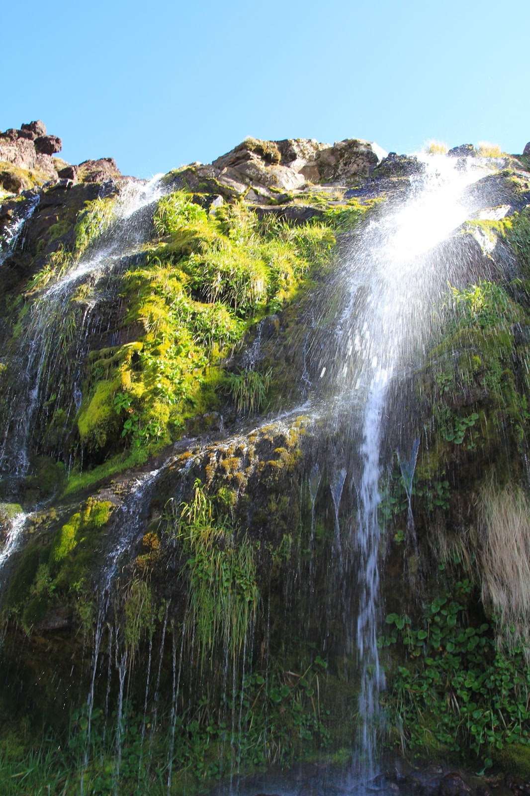
From the toilet stop, we could spot the Soda Springs, which was actually out of the way from our route, but we decided to check it out anyway.


Found a perfect little rainbow at Soda Springs. Took us about 1.5 hours from the carpark to Soda Springs.


When you see this sign, it means the real deal is ahead of you. You can either turn back now, or keep moving forward.


Lots of mounting hills and climbing up stairs, here's a stop where you can just sit and enjoy the view.

Still pretty happy and surviving.


The route from Soda Springs to the South Crater was pretty challenging, this route is also called the Devil's Staircase. We took about 1 to 1.5 hours. Met some fellow Singaporeans at the peak and they took this photo for us.


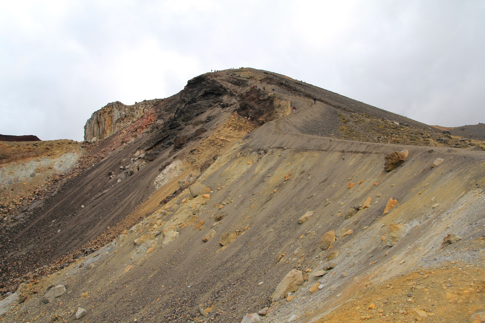
Another short climb to the Red Crater after the South Crater, this is less strenuous than the previous one. It took us about an hour. Below is a picture of the red crater that has already dried up. There were rock formations formed by people on it.

When we were below walking on flat land, the people looked like ants on the mountain. We were making fun of them until we realised that it is yet another climb up.


Streaks of ice on the mountains.

This was the toughest part for me. We had to hold onto metal chains to climb up the rocks and also a metal wire so that we can get across. There was very little footing, so I held on pretty tightly and as I was sliding my hands through the metal wire, I got cut. Arrived at the top to be awed by this view, but my hand was bleeding. At that point in time, I almost wanted to cry, I knew I had no choice but to carry on, because I couldn't turn back anymore, but I didn't know what other challenges lies ahead. It was a mixture of exhaustion, pain and being caught in a dilemma.
Thankfully the boy kept pushing me on and he was truly my pillar of support.


View of the Red Crater from the top.


What goes up, must come down. This was a really steep downhill. We had nothing to hold on to, so that was what made it scarier. A trekking pole would come in handy at a time like this. I hated climbing up, whereas the boy hated going down.
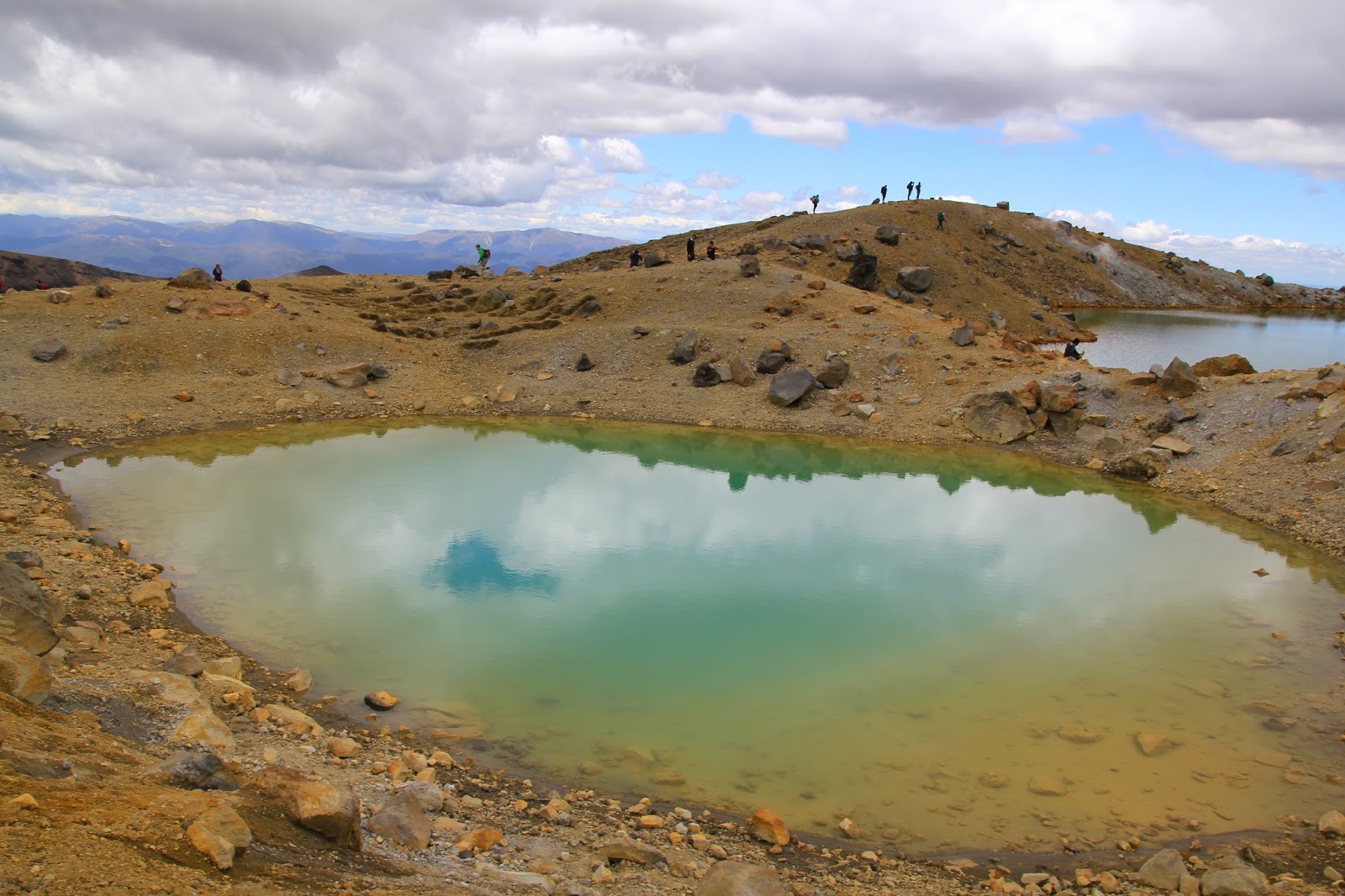
Beautiful Blue Lake right before our eyes. It took us quite awhile to get down and trust me when I say your legs turn jelly (figuratively and literally).


Stunning.


I fell on my bum while slipping off the rocks here.


A huge patch of ice up in the mountains. At this point in time, we couldn't be bothered with it and just kept on walking.


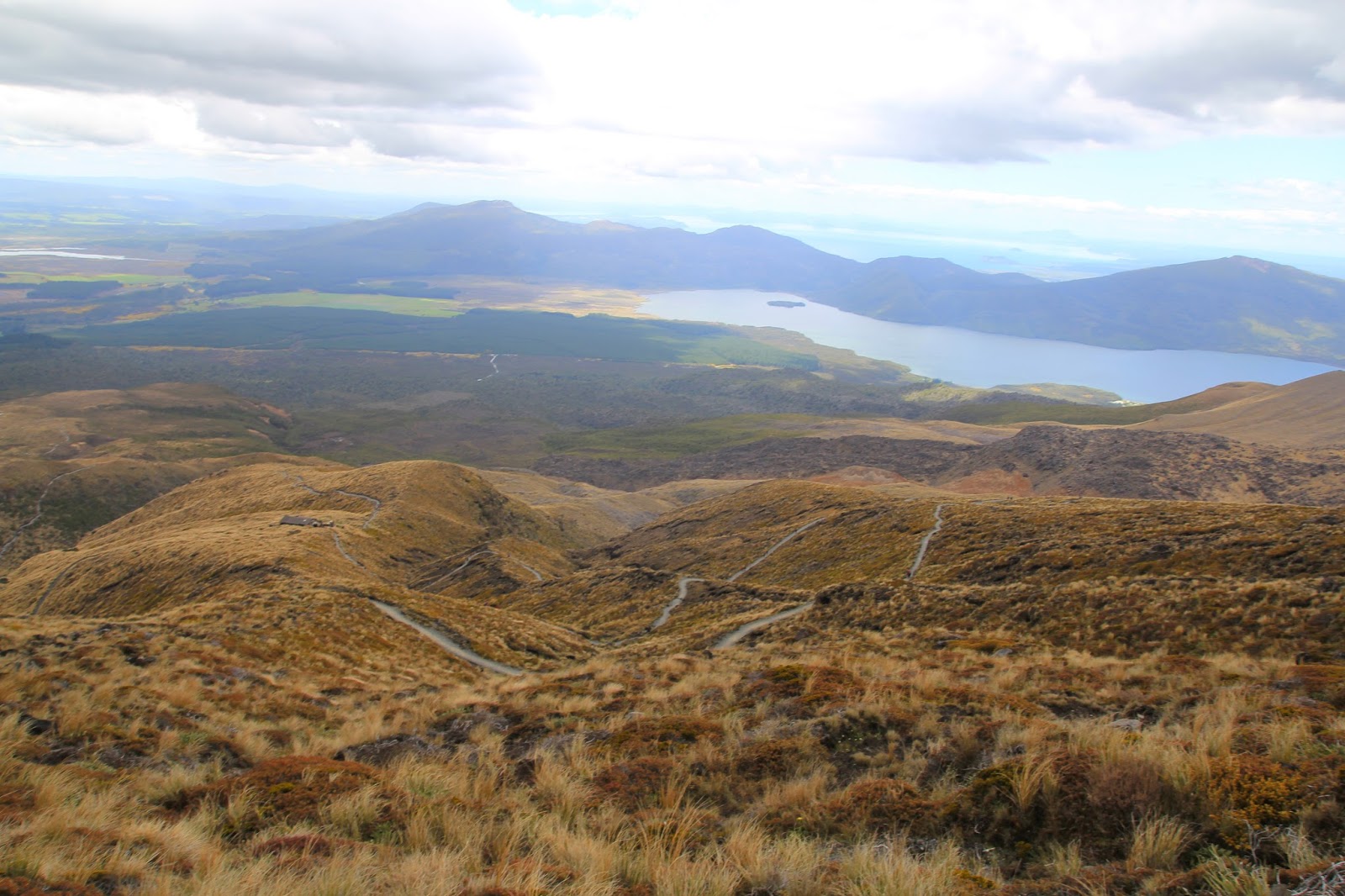
The winding route to Ketetahi Hut from Blue Lakes, so near yet so far. We walked really fast here because it was a mild slope downhill. Ketetahi Hut is also where the toilet is.


Amazing view and my hair is in a complete mess but I don't care.


Just when we thought we were about to reach, there was another 2 hours more from Ketetahi Hut to the carpark.

It was a walk through the forest, which reminded us of Twilight.

& this is what heaven looks like. Well, at least for that day.

The end of the track, with happy faces smiling back at us. We made it!

En route to Wellington, I couldn't feel my legs anymore when I was in the car.

Hey there, gorgeous.

It was an awesome experience and I'm really proud of my achievement. Couldn't have done it without the boy. I hope this post has been helpful to those who are planning to track Mount Tongariro! Do remember to apply plenty of sunblock, I've gotten a few shades darker even when I was constantly applying it.
No comments:
Post a Comment